See how Flash Forest is accelerating reforestation across Canada. Download our latest Impact Report
Solutions
Company
Resources

501 Alliance Avenue Toronto, ON, M6N 2J1 Canada
INFO@FLASHFOREST.CA
See how Flash Forest is accelerating reforestation across Canada. Download our latest Impact Report
forest intelligence
service
Flash Forest provides LiDAR, and multi-spectral forest surveys that replace statistical guess work with absolute inventory. We deliver a census-level digital twin of a block.
The annual harvest of millions of hectares of forest necessitates rigorous regeneration and subsequent monitoring. For forest tenure holders, these evaluations are a regulatory cornerstone.
Current monitoring methodologies often rely on a combination of coarse, subjective aerial-ocular data and localized ground sampling.
This technical deficiency leads to undetected regeneration failures, escalating operational costs, and potential future revenue loss.
Current surveys rely on coarse aerial-ocular information and in some cases, ground-based sampling that lack precision.
Regeneration issues often go unnoticed for years which leads to unplanned treatment costs and undesirable forest conditions.
Poorly timed silviculture practices result in undesirable Free To Grow outcomes which impact merchantable timber volumes and AAC.
Manual surveys are slow, pose safety risks, and often require boots on the ground in hard-to-reach locations.
Modernize post-harvest regeneration with drone-based surveys powered by machine learning and high-resolution LiDAR data.
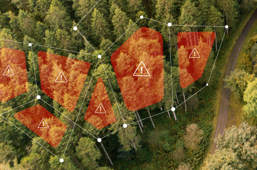
Flash Forest solution detects species composition, height thresholds, stem density and competition metrics with census-level precision.
Accurate. Fast. Complete.
01
Deep learning models are trained on data across boreal, montane and temperate forest terrain. We classify tree species, measure stem height and calculate density. Algorithms detect competition from non-crop vegetation and assess stocking metrics against regulatory thresholds.
02
.png)
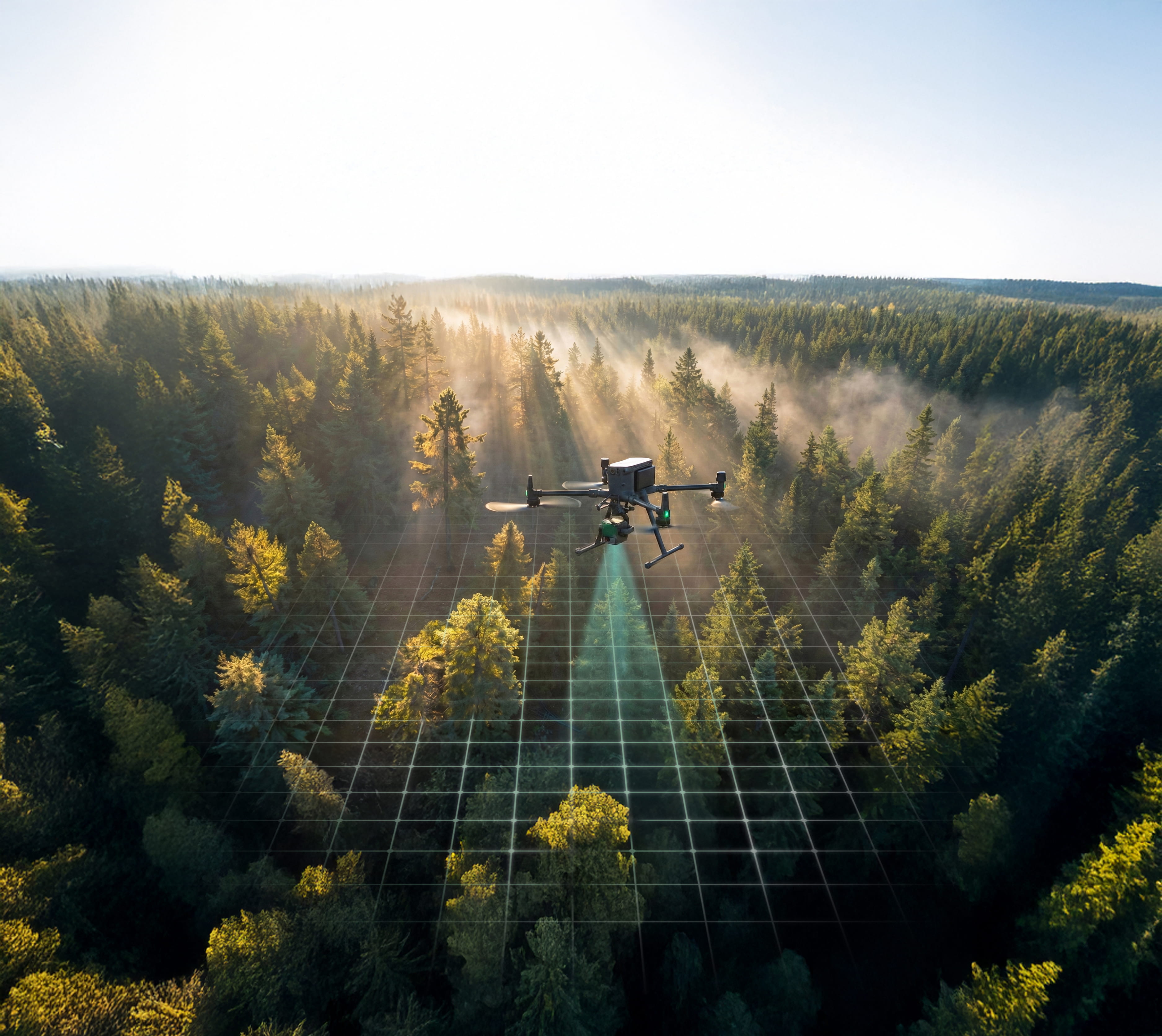
Drones equipped with LiDAR sensors map terrain and vegetation structure at centimeter level accuracy. Multispectral cameras capture data across visible and near-infrared wavelengths. When combined with machine learning we detect species composition, height and stem density.
03
Survey-grade drones cover 1,000s of hectares per day. Custom mission plans flown at low elevation ensure complete block coverage with the highest possible resolution and accuracy.
04
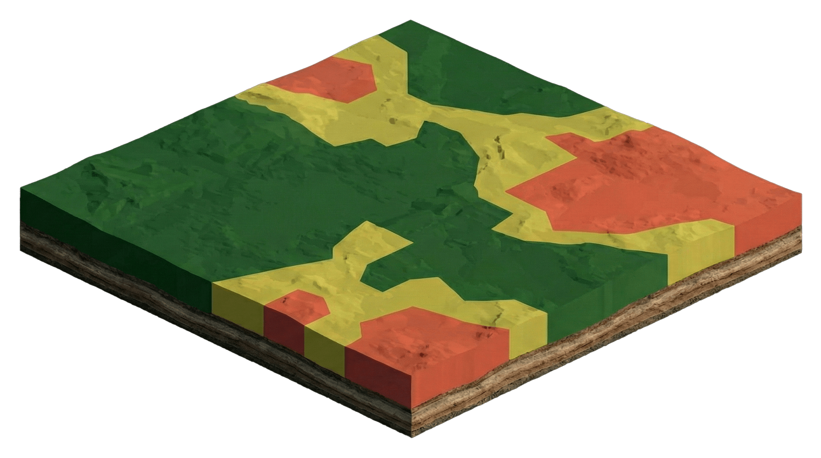
Reports provide block-wide statistics and spatial maps showing compliant versus non-compliant areas. Data integrates with GIS platforms for treatment planning and compliance exports. We engage and involve regulators to ensure FIS reporting meets official standards in every region that we operate.
-min.avif)
